
Saturday, June 27, 2009
GOES-O
NASA's new meteorological satellite has been launched and is expected to begin operating at the end of the year.
Click here to follow NASA's GOES-O launch blog.
Click here to follow NASA's GOES-O launch blog.
Friday, June 26, 2009
Video From The Severe Storm Earlier Tonight
Video from the one severe thunderstorm that I was able to film last night. Two lightning bolts struck REALLY close and I was able to catch them both. I will be uploading a clip of the one that struck closest very soon.
Thursday, June 25, 2009
Semi Truck Blown Over By High Winds
THE NATIONAL WEATHER SERVICE IN WILMINGTON HAS ISSUED A
* SEVERE THUNDERSTORM WARNING FOR... WESTERN FAIRFIELD COUNTY IN CENTRAL OHIO... SOUTHERN FRANKLIN COUNTY IN CENTRAL OHIO... NORTHERN PICKAWAY COUNTY IN CENTRAL OHIO...
* UNTIL 1045 PM EDT.
* AT 1000 PM EDT...LOCAL LAW ENFORCEMENT REPORTED A SEMI TRUCK BLOWN OVER SOUTHWEST OF COLUMBUS. RADAR INDICATED THAT THIS SEVERE THUNDERSTORM REMAINS CAPABLE OF PRODUCING WINDS TO 60 MPH. THIS STORM WAS LOCATED NEAR OBETZ...MOVING SOUTHEAST AT 25 MPH.
* LOCATIONS IMPACTED INCLUDE... GROVEPORT... ASHVILLE... CANAL WINCHESTER...
IN ADDITION...OBETZ...LOCKBOURNE... DUVALL...LITHOPOLIS...SLATE RUN METRO PARK AND CARROLL ARE NEAR THE PATH OF THIS SEVERE THUNDERSTORM.
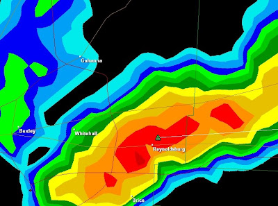
Even More Severe Weather
I really wish my camera battery wasn't so low on power. I missed the earlier severe storm in the northern part of Franklin county and I'm currently missing this severe storm:

However, I had just enough juice in my camera to film the severe storm that rolled over top of us earlier. I filmed some awesome lightning bolts, including one that stuck VERY close and knocked all the power out in our apartment complex for a few seconds. I haven't even watched it yet, but it will be uploaded soon.

However, I had just enough juice in my camera to film the severe storm that rolled over top of us earlier. I filmed some awesome lightning bolts, including one that stuck VERY close and knocked all the power out in our apartment complex for a few seconds. I haven't even watched it yet, but it will be uploaded soon.
More Severe Weather
THE NATIONAL WEATHER SERVICE IN WILMINGTON HAS ISSUED A
* SEVERE THUNDERSTORM WARNING FOR...
DELAWARE COUNTY IN CENTRAL OHIO...
NORTHEASTERN FRANKLIN COUNTY IN CENTRAL OHIO...
LICKING COUNTY IN CENTRAL OHIO...
* UNTIL 915 PM EDT.
* AT 815 PM EDT...NATIONAL WEATHER SERVICE DOPPLER RADAR INDICATED A
LINE OF SEVERE THUNDERSTORMS CAPABLE OF PRODUCING PENNY SIZE HAIL
AND WINDS TO 60 MPH. THESE STORMS WERE LOCATED ALONG A LINE
EXTENDING FROM WARRENSBURG TO 21 MILES NORTH OF FALLSBURG...MOVING
SOUTHEAST AT 30 MPH.
* LOCATIONS IMPACTED INCLUDE...
DELAWARE...
SUNBURY...
UTICA...
WESTERVILLE...
JOHNSTOWN...
GRANVILLE...
GRANVILLE SOUTH...
SUMMIT STATION...
IN ADDITION...WARRENSBURG...KILBOURNE...OLIVE GREEN...STRATFORD...
INTERSTATE 71 AT US ROUTE 36/STATE ROUTE 37...LEWIS CENTER...GALENA
AND HARTFORD ARE NEAR THE PATH OF THESE SEVERE THUNDERSTORMS.

Tornado Warning For Southeastern Pickaway County
THE NATIONAL WEATHER SERVICE IN WILMINGTON HAS ISSUED A
* TORNADO WARNING FOR...
SOUTHEASTERN PICKAWAY COUNTY IN CENTRAL OHIO...
EASTERN ROSS COUNTY IN SOUTHWEST OHIO...
* UNTIL 415 PM EDT.
* AT 343 PM EDT...NATIONAL WEATHER SERVICE DOPPLER RADAR INDICATED A
SEVERE THUNDERSTORM CAPABLE OF PRODUCING A TORNADO. THIS DANGEROUS
STORM WAS LOCATED NEAR KINGSTON...MOVING SOUTH AT 5 MPH.
* THIS DANGEROUS STORM WILL AFFECT MAINLY RURAL AREAS OF EASTERN ROSS
AND SOUTHEASTERN PICKAWAY COUNTIES...INCLUDING HALLSVILLE AND
MOORESVILLE.

Sunday, June 21, 2009
Severe Thunderstorm Video From Last Night
I really wish that I could have filmed this during the day. There where some VERY strong wind gusts in this storm. I think this makes the first time I've been startled by a microburst. See if you can tell when in the video.
Saturday, June 20, 2009
Severe Thunderstorm With Training Cells Video
Here is the video from the severe thunderstorm that occurred yesterday morning and the cells that kept popping up behind it and moving over the same area (known as thunderstorm training).
Part One
Part Two
Nighttime Severe Thunderstorm
Just got back from filming this severe thunderstorm.

I wish it wasn't night. My car took on the full brunt of a couple of at least 50MPH wind gusts (while I was parked). The trees where whipping and my car was shaking. I had to roll up my window because I was being pelted by hard rain.
Video will be uploaded once I've edited and uploaded the storms I filmed yesterday morning.
Friday, June 19, 2009
Tornado Warnings
I've gotten very little sleep today because the weather radio has been going off every 20 minutes.
Latest warnings are tornado warnings for Licking, Knox and Holmes counties.

If you're in Ohio today, be careful and keep a look out.
Latest warnings are tornado warnings for Licking, Knox and Holmes counties.

If you're in Ohio today, be careful and keep a look out.
Severe Thunderstorm
Filmed a severe thunderstorm with training cells.

I got some awesome footage but unfortunately I need sleep. I should have a little time to edit it tomorrow after I finish my school work for this week.

I got some awesome footage but unfortunately I need sleep. I should have a little time to edit it tomorrow after I finish my school work for this week.
Severe Thunderstorm Watch
The radar images have been looking impressive today.

About to head out and film.

About to head out and film.
Sunday, June 14, 2009
Tornado Warned Storm In Southern Ohio
THE NATIONAL WEATHER SERVICE IN WILMINGTON HAS ISSUED A
* TORNADO WARNING FOR...
NORTHERN LEWIS COUNTY IN NORTHEAST KENTUCKY...
SOUTHERN ADAMS COUNTY IN SOUTHWEST OHIO...
* UNTIL 600 PM EDT.
* AT 519 PM EDT...NATIONAL WEATHER SERVICE DOPPLER RADAR INDICATED A
SEVERE THUNDERSTORM CAPABLE OF PRODUCING A TORNADO. THIS DANGEROUS
STORM WAS LOCATED NEAR WEST UNION...MOVING SOUTHEAST AT 15 MPH.
* LOCATIONS IMPACTED INCLUDE...
WEST UNION...
VANCEBURG...
IN ADDITION...STATE ROUTE 348 AT STATE ROUTE 125...CONCORD...BLUE
CREEK...SANDY SPRINGS...ROME AND CARRS ARE NEAR THE PATH OF THIS
DANGEROUS THUNDERSTORM.

Also, an update:
THE NATIONAL WEATHER SERVICE IN WILMINGTON HAS ISSUED A
* TORNADO WARNING FOR...
NORTHEASTERN LEWIS COUNTY IN NORTHEAST KENTUCKY...
SOUTHEASTERN ADAMS COUNTY IN SOUTHWEST OHIO...
SOUTHWESTERN SCIOTO COUNTY IN SOUTHWEST OHIO...
* UNTIL 615 PM EDT.
* AT 536 PM EDT...NATIONAL WEATHER SERVICE DOPPLER RADAR INDICATED A
SEVERE THUNDERSTORM CAPABLE OF PRODUCING A TORNADO. THIS DANGEROUS
STORM WAS LOCATED NEAR ROME...MOVING EAST AT 20 MPH.
* LOCATIONS IMPACTED INCLUDE...
VANCEBURG...
IN ADDITION...SANDY SPRINGS...BUENA VISTA...TURKEY CREEK
LAKE...SHAWNEE STATE FOREST...TANNERY...GARRISON...FRIENDSHIP...
REXTON AND SAINT PAUL ARE NEAR THE PATH OF THIS DANGEROUS
THUNDERSTORM
Following the tornado warned storm, there is now a flood warning for the area it traversed over.
THE NATIONAL WEATHER SERVICE IN WILMINGTON HAS ISSUED A
* FLASH FLOOD WARNING FOR...
ADAMS COUNTY IN SOUTHWEST OHIO...
SOUTHWESTERN SCIOTO COUNTY IN SOUTHWEST OHIO...
* UNTIL 830 PM EDT.
* AT 601 PM EDT...THUNDERSTORMS WITH HEAVY RAIN WERE CONTINUING TO
PUSH SOUTHEAST ACROSS ADAMS AND SOUTHWEST SCIOTO COUNTY. SINCE 4
PM...TWO TO LOCALLY THREE INCHES OF RAIN HAS ALREADY FALLEN FROM
NEAR CHERRY FORK THROUGH WEST UNION INTO FAR SOUTHWEST SCIOTO
COUNTY. ANOTHER ONE TO LOCALLY TWO INCHES OF RAIN WILL BE POSSIBLE
THROUGH 7 PM.
SOME LOCATIONS THAT MAY EXPERIENCE FLOODING INCLUDE...SEAMAN...WEST
UNION AND WINCHESTER.
Friday, June 12, 2009
Intense Rain And Funnel Cloud
Here is video of the intense rain we got yesterday along with the funnel cloud that I spotted.
If you listen to the weather radio I had going while in my car, you can hear them report the funnel clouds being spotted at the time. A little while later, I spotted one of my own, filmed it, and documented the hook on radar. This thundershower took on a shape similar to a a super cell before it passed over us and formed the funnel after it left. A few minutes later it lost all of it's strength.
Here is a screen capture of the hook shape that appeared on radar at the time I was filming the brief funnel.

Tuesday, June 2, 2009
Nighttime Lightning Show
Me and my roommate Drew drove out to film this thunderstorm last night. It produced a lot of lightning and I got so much great footage that I had to edit and upload it in to two parts.
Part 1
Part 2
The storm turned severe just as it was passing over and around us.

The storm turned severe just as it was passing over and around us.

Monday, June 1, 2009
The 2009 Atlantic Hurricane Season Is Here
The 2009 Atlantic hurricane season officially starts today.
I will be gathering Atlantic hurricane and tropical storm related links again this year so stay tuned!
I also have much better radar software this year, so as the storms approach land, I will literally have a much better picture of what is going on inside the storm.
I wish everyone that lives on the coasts the very best this year. I have family that lives on the coast of South Carolina so I know how nerve racking this time of year can be for some. It's important to realize that these storms happen for a reason. They are part of the cycle that helps maintain our global climates. These storms have been happening since before humans started recording them. The risk of living in a coastal community may be foreshadowed by how pleasant it is most of the year, but being ready for these natural occurrences is a must for all who could potentially be in harm's way this hurricane season and beyond.
Subscribe to:
Posts (Atom)

